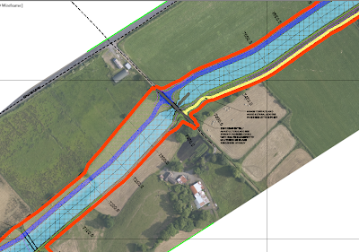
In the screen grab below we see part of a 15km proposed new canal design. The thick orange line is the land take line along which a fence needs to be erected. We need to create points along this line at 15m intervals and then export these out to csv file for upload to our GPS logger for setting out. Needless to say you don't want to be manually specifying each point location so the following is a workflow for speeding up the process.

We will use the point creation tools to create the points but before we do we will modify the command settings so that we are not prompted to enter a description for each point. In the Settings tab of toolspace expand points<Commands and right click on CreatePoints and select edit command settings. Here we change the settings as below to enter a default point description of FENCE SETOUT and set the prompt value to Automatic. In my case I have set the prompt for elevations to Automatic also which will pick up the level of the chosen surface but this may not be needed.
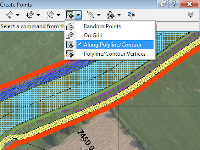
Next go to Points on the Home ribbon and select point creation tools. On the Create Points toolbar select Along Polyline/Contour as below.

Select your surface if prompted/ needed. Specify distance between points and then select the polyline representing the fence. This will create points along the polyline with the default description.
Next to get these points out to a point file to import into your logger you can create a new point group and export this.
On the Prospector tab of toolspace right click on Point Groups and select new. Give the point group a name and set the point and label styles.
On the Include tab tick the box beside With Raw Descriptions Matching and enter the point description. This will dump all your fence set out points into one point group giving us easier control over them.
Now to export to point file, right click on the point group name and select export.
Choose the point file format and specify destination (you specify file type (csv, txt, xls) here also. Tick the box to limit to a point group and click ok.
This will get your fence setout points to a file format that can easily be uploaded to logger for set out.


No comments:
Post a Comment